ISRAEL MURDERED MORE CHILDREN
than any other country in the world*
Stop ISRAELI WAR CRIMES and GENOCIDE
than any other country in the world*
Stop ISRAELI WAR CRIMES and GENOCIDE
Your Seeds Source...
|
ISRAEL MURDERED MORE CHILDREN
than any other country in the world* Stop ISRAELI WAR CRIMES and GENOCIDE Your Seeds Source...
| ||
| ||
27 june 2009
From 3200 to 3600 m. comes a section with more plants in bloom (june 2009) and more species, but compared to Putre it is much poorer. One of the possible reasons for that may be because the area with ...
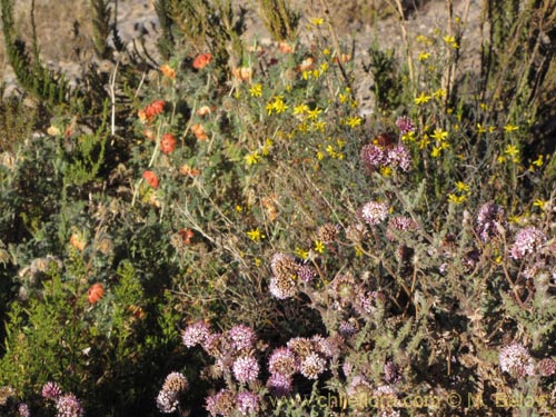
Among the species worth mentionning are for instance Caiophora chuquitensis which grows on steep slopes overviewing the Chusmiza village. In addition, in an area some 10 km. down from Chusmiza just a few meters from a parking lot (the only one in the area) there is a field with Mastigostyla cyrtophylla. Unfortunately, we do not have a photo of a blooming plant, only dry rests, but the plant is very attractive - it is a bulbous plant with blue flowers formed by three large tepals and three rather short tepals.
After passing Chusmiza, the road climbs quiclkly up to analtitude of 3800 - 4200 m and continues for the next 80 km. across semi-desert landscape where the dominant vegetation type is high-altitude grass-land.
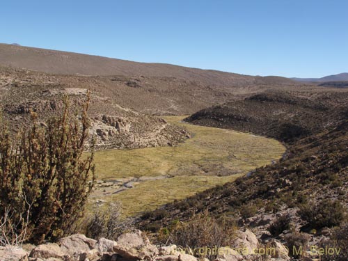
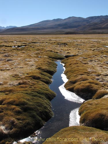
Small bogs or bofedales, as they are called in Spanish can be seen at the bottom of the narrow valleys, often not wider than 10 or 20 meters. But the flora which can be found on these bogs is also quite limited in species number, with Oxychloe andina and a few poaceae. Halfway though the way one will pass a
A mitad de camino uno pasará un ralo bosque de queñoas, Polylepis tarapacana. During the last 15-20 km. one will see "tolares", bush land consisting in some areas Lampaya medicinalis and Acantholippia punensis, both plants having many medicional properties, often used by the local Indians. Especially the second one is a very aromatic herb called ricarica and is used to prepare a kind of té.
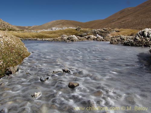
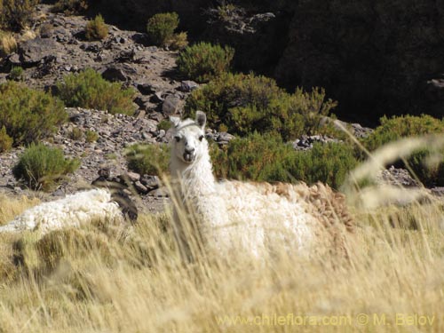
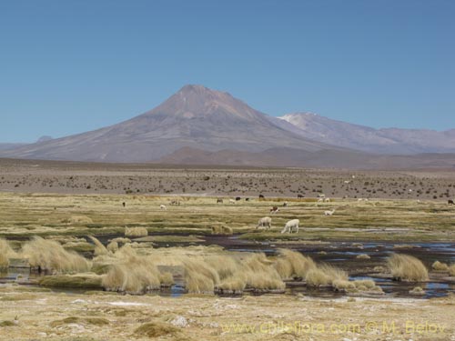
Some 5 kilometers before arriving at Colchane the road crosses the river Isluga which forms a larger bog there with several bird species and which is heavily pastured by the domesticated llamas.
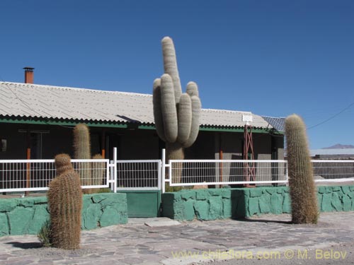
A side trip to Colchane is not really worth it. By the High Andean standards, Colchane is not that high, it is located at "only" 3700 m. and consists of only one street, Wild West style. Thge only botan attraction of the village are the enormous cacti of Echinopsis atacamensis ssp. atacamensis in front of the police station and the municipality.
Al volver hacia el puente que cruza el río Isluga se puede internarse por otra ruta dentro del Parque Nacional Isluga. Este trayecto es bastante más interesante que Colchane, pero otra vez, la diversidad de especies de plantas es bastante inferior a la del Parque Lauca y la zona de Putre.
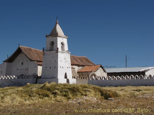
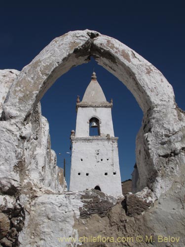
The first required stop is at the small village of Isluga, where a church with white bell tower stands out. It is constructed almost on the bog, which is by no means accidentalk, because in manmy cases the settlement location was selected on the basis of its proximity to pastures. Parinacota, another emblematic village of High Andes in the Lauca National Park is also located just a few steps away from a huge bog.
The churches are obligatory attributes of the high-andean culture and one can see them in almost all villages of the Altiplano, including the smallest ones. This is rather unfrtunate, the catholicmissionaries wreaked havoc among the indigionous popuñlation, trying to destroy their culture and believes and to impose the catholic doctrine.
The churches are the heritage of this cultural destruiction. Despite their negative impact, the catholic way of life was mixed with the indiginous culture and produced a syncretism which under the thin veneer of acceptance of the foreign belief system preserved to a large extent the ancestral bliefs and way of life.
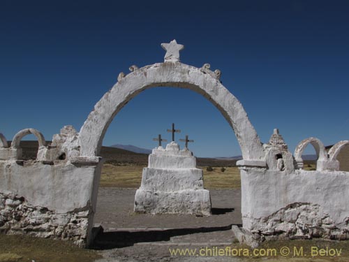
Al mirar detenidamente estas creaciones arquitectónicas uno puede observar muchos aspectos paganos, ofrendas, ídolos, e incluso el estilo arquitectónico es muy propio del estilo de construcción local, con base ensanchada (píramide truncada), por lo que hay que tomarlas no como expresión de catolicismo, sino como el poder de supervivencia, como una rebelión interiorizada de una etnia sometida al lavado de cerebro...
Desde Isluga el camino avanza otros 10 km. por un tolar seco y poco interesante, donde una de las pocas especies presentes es Lampaya medicinalis hasta que entre en una estrecha quebrada; casi siempre uno puede observar llamas pastoreandose dentro del agua, y en las laderas empinadas uno puede encontrar especies de flora más interesantes, como por ejemplo Caiophoras, Senecios, y Llaretas. Al continuar por el camino uno pronto llega al bofedal plano de Laguna Arabilla.